- Itineraries
- Itineraries of Nature and Wildlife
- High Route of Valmalenco
- High Route - 4th stage alternative
High Route - 4th stage alternative
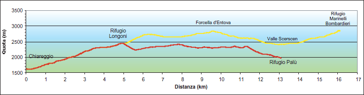
Longoni refuge hut -
Marinelli refuge hut
Best time to visit
Summer
Gradient
 700 metres
300 metres
Distance
11 km
Walk time
6 h
 Longoni refuge hut
Marinelli refuge hut
Waymark

Route
Longoni refuge hut 2,450 m - Forcella d'Entova 2,830 m - Marinelli refuge hut 2,813 m
Follow the path to reach the wide ridge overlooking the hut to the south-west of Sassa d'Entova, and continue up to approximately 2,750 m, where the path descends slightly.
It then traverses the wide valley of Entovasco as far as Pian dei Buoi and continues to the clearly visible Forcella d'Entova.
Descend from the pass along the wide natural terrace in a east-north-easterly direction towards the bottom of the deep Scerscen valley.
At about 2,620 m, you can continue along the ridge to the left, passing the rocky limestone crags (a stretch of ferrata) of one of the most important karstic areas of the Valmalenco, to reach the first of the glacial torrents (bridge) of the Scerscen glaciers.
This is where you will rejoin the original route.